


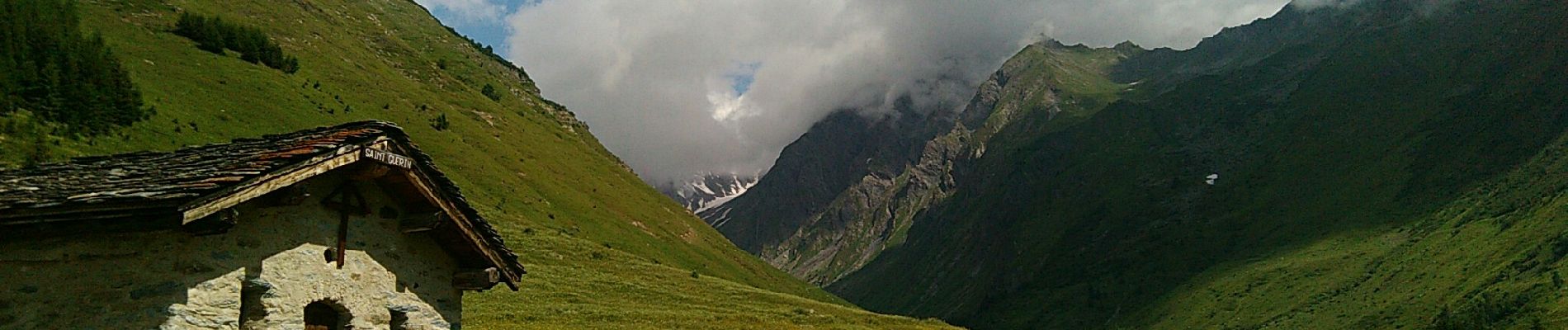
F73 Beaufortain J4 Presset Saint Guérin

ageo
User
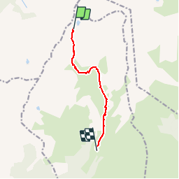

Length
6.9 km

Max alt
2442 m

Uphill gradient
4 m
Km-Effort
9.7 km

Min alt
1590 m

Downhill gradient
843 m
Boucle
No
Creation date :
2018-07-07 07:08:00.947
Updated on :
2018-07-07 07:40:02.518
1h34
Difficulty : Easy

FREE GPS app for hiking
 SityTrail
IGN / Geographical institutes
SityTrail Plus
The world is yours!
About
Trail Walking of 6.9 km to be discovered at Auvergne-Rhône-Alpes, Savoy, La Plagne-Tarentaise. This trail is proposed by ageo.
Description
File with points/tracks from Locus Map/3.31.3
Photos


Positioning
Country:
France
Region :
Auvergne-Rhône-Alpes
Department/Province :
Savoy
Municipality :
La Plagne-Tarentaise
Location:
La Côte-d'Aime
Start:(Dec)
Start:(UTM)
317877 ; 5057544 (32T) N.
Comments